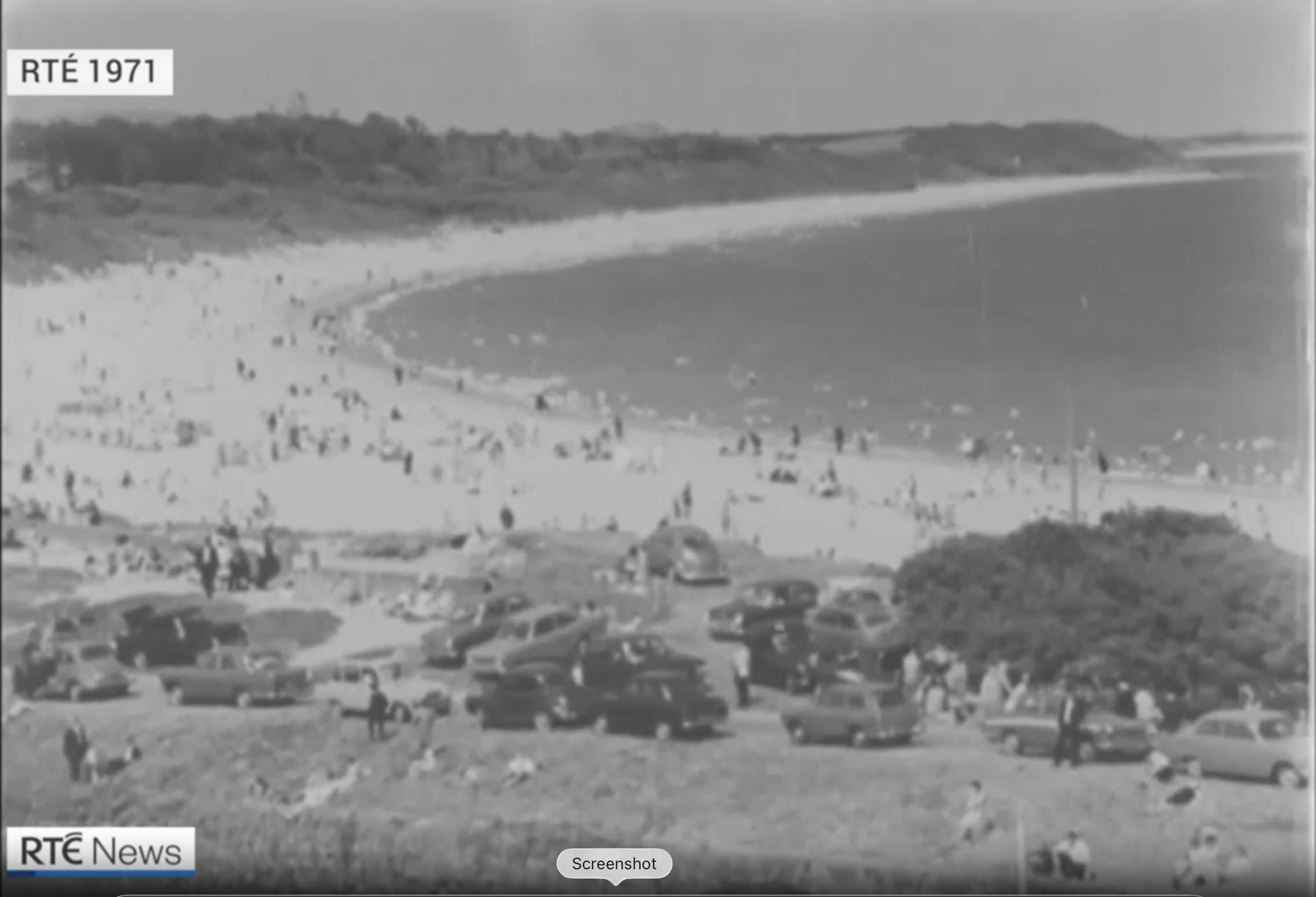
RTÉ News archive view of a crowded sandy beach at Courtown in 1971

Courtown, 1971 · Source: RTÉ News, 4 July 2025
Courtown todayPersonal video

Courtown today

Co. Wexford

Land lost over 40 years18 football pitchesReported by RTÉ News · 4 July 2025
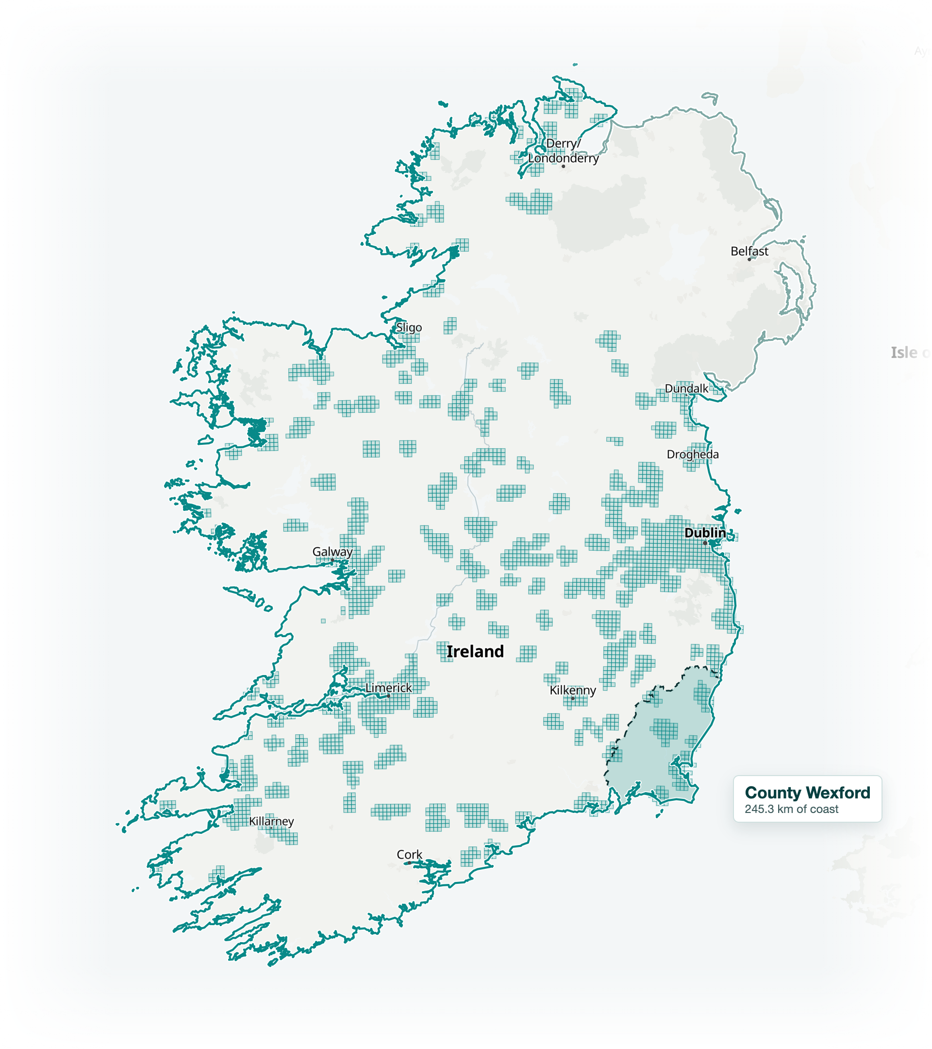
Island of Ireland with County Wexford highlighted in CoastLens teal

County Wexford

4.2%*

of Ireland’s coastline

* ROI coastline only · Island map includes Northern Ireland. Display simplified from retained source geometry.
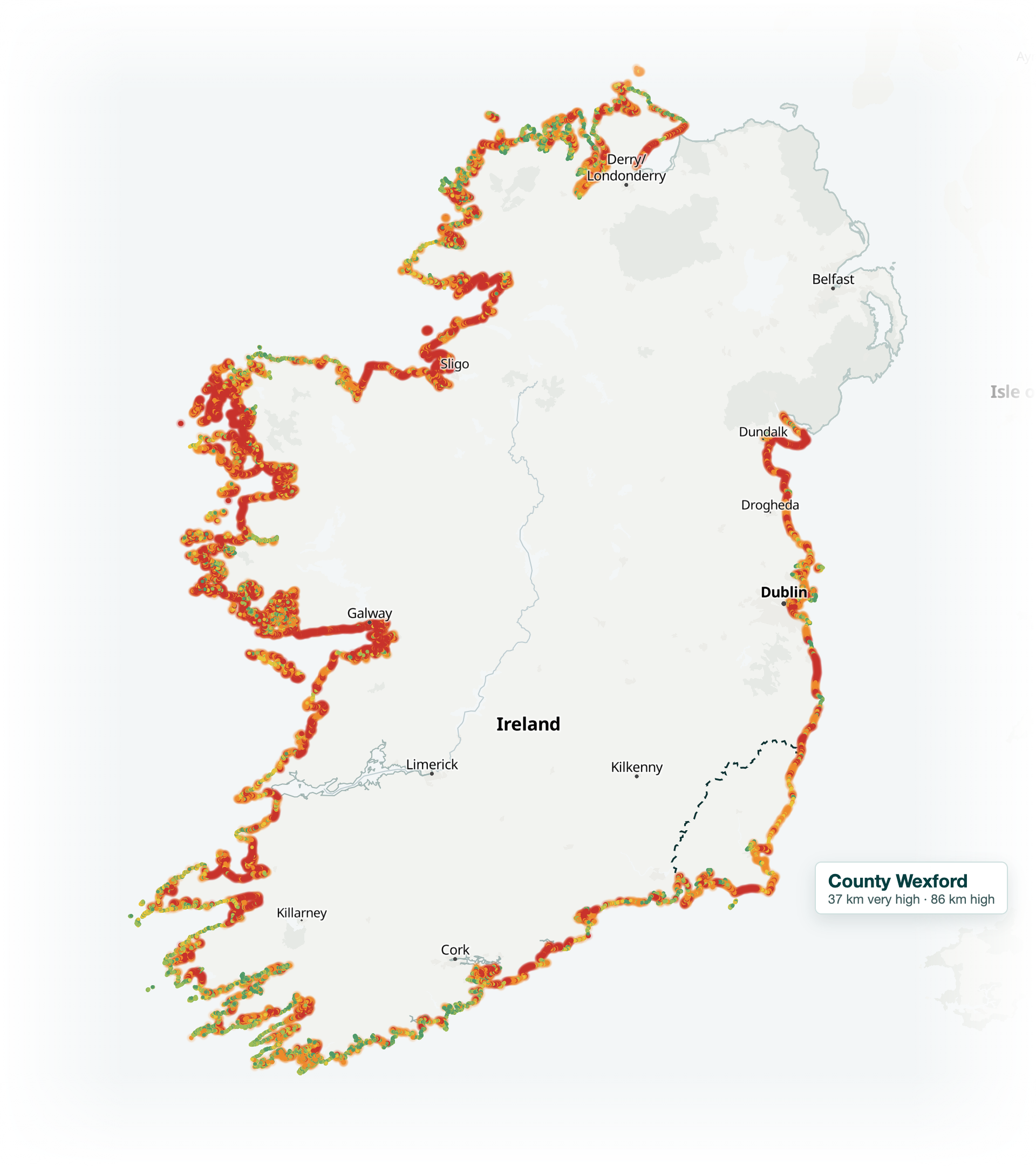
Island of Ireland with UCC's Coastal Exposure Index drawn on the CoastLens map: 34,303 points at 250 m coloured from green (very low) to red (very high exposure), red concentrated along the west coast, County Wexford outlined

Ireland's coast · the national picture

1 in 5*

of Ireland's coastline at very high exposure

very lowvery high

Wexford: 37 km very high, 86 km high, 15,200 people within 500 m of the coast.

* UCC Coastal Exposure Index, Walsh, De Oliveira, Keenahan and Lim 2026, Nat Hazards 122:627 · 8,575 km at 250 m · drawn on the CoastLens map with permission for non-commercial use, attributed · reported by The Irish Times, 8 September 2026

Ireland’s named-storm record

87 storms since 2015

Benchmark eventStorm Kathleen6 April 2024 · Wexford

National presentation index using observed extrema. Not a local impact score.

The CoastLens evidence stack

Twelve data families. One coastal picture.

Research accelerated withManus

Proposed agent workflow

Storms and weather
Wave observations
Water levels
Shoreline geometry
Terrain and LiDAR
Seabed and nearshore
Satellite imagery
Flood and surge
Council records
Damage testimony
Local observations
Research and methods
DiscoverParseCheckAssemble
CoastLens

Deterministic engine

Accepted numerical inputs

AI prepares evidence. Accepted numerical inputs feed the engine; contextual evidence also supports review and briefing.

The workspace

Introducing CoastLens

A Geographic Information System (GIS)

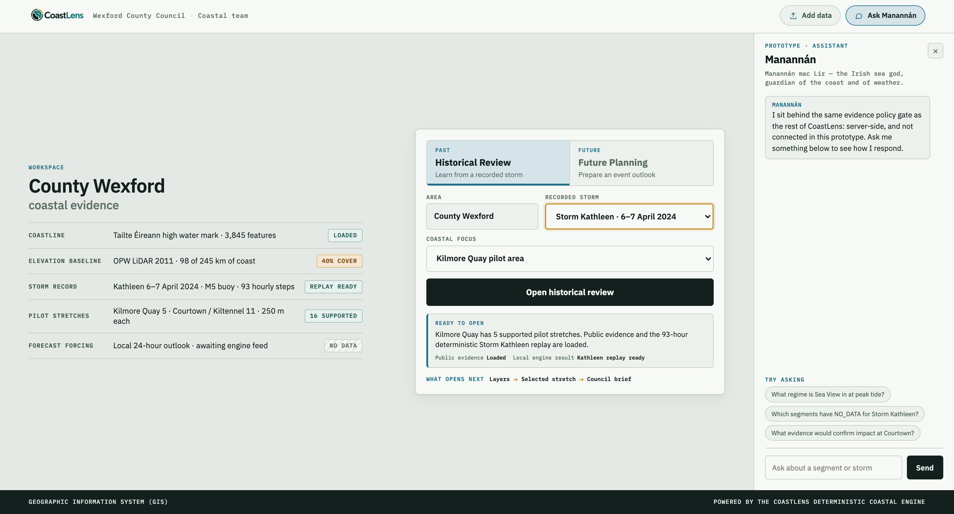
CoastLens workspace: Start an analysis, Historical Review or Future Planning, County Wexford, Storm Kathleen, Add data and Ask Manannán, with the Manannán assistant panel open

The workspace · how it works

Introducing CoastLens

CoastLens workspace washed back, with three callouts: Past or future, Add data, Ask Manannán
1
Past or future.

Review a recorded storm, or prepare for the next one. One engine, two directions.

2
Add data.

Council files join the same governed evidence workflow. Data and research agents take it from there.

3
Ask Manannán.

Answers only from the project’s own evidence, behind the same policy gate as the engine.

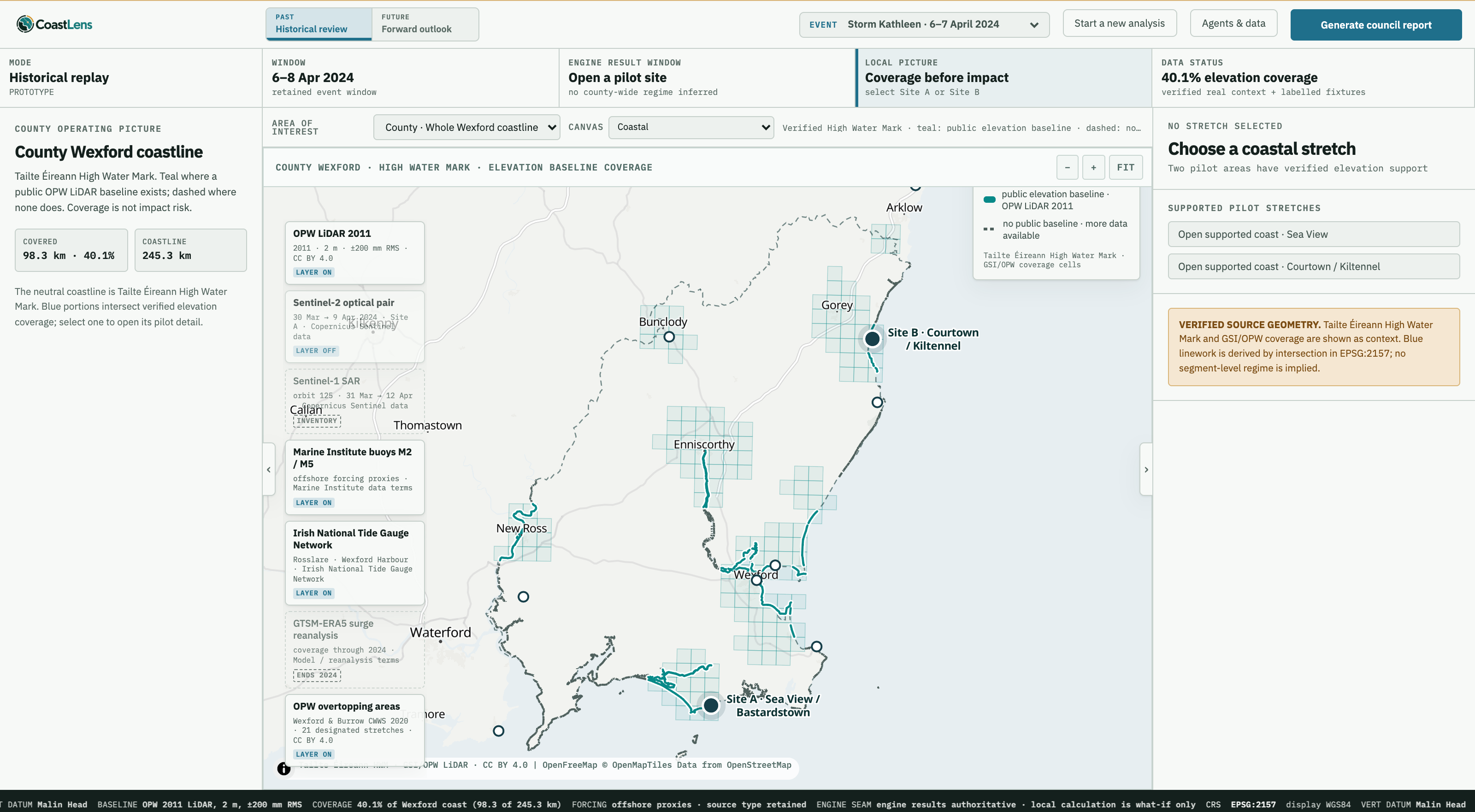
Storm Kathleen review · 01

Start with the whole county

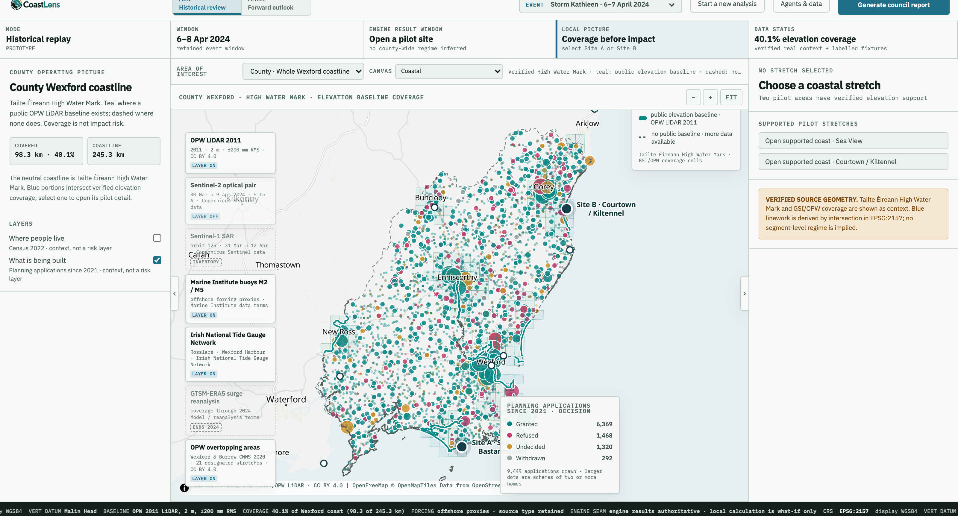
CoastLens GIS, County Wexford view: high water mark in teal where a public LiDAR baseline exists and dashed where none exists, LiDAR cells, both pilot sites, evidence inventory on the left and the selected-stretch rail on the right

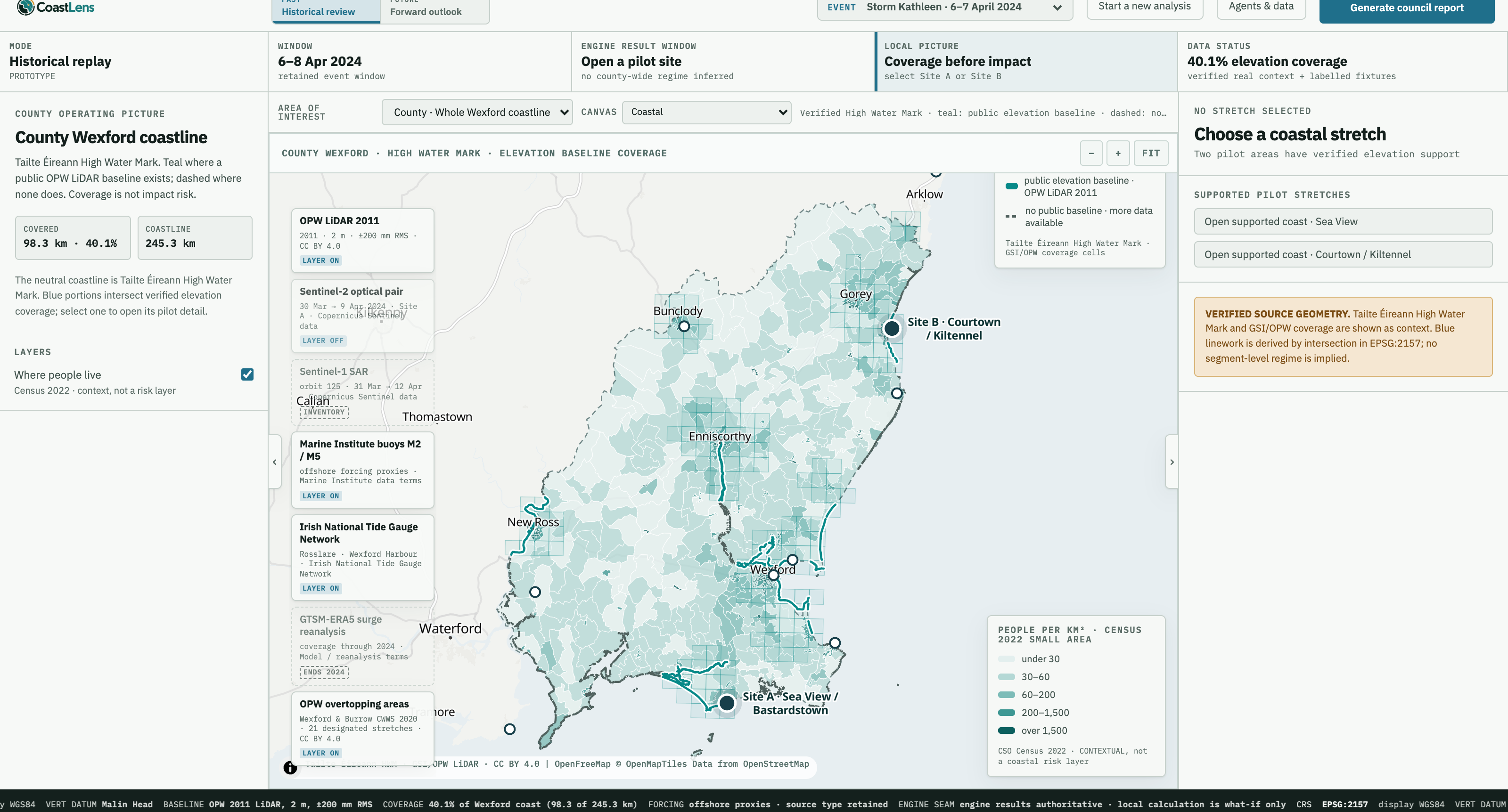
Storm Kathleen review · 02

Where people live

CoastLens GIS, County Wexford view with the Where people live layer on: Census 2022 population density by small area shaded in teal under the high water mark, legend showing five density bands, labelled context, not a coastal risk layer

Storm Kathleen review · 03

Sixteen hours later

Two stretches in Overwash, three in Collision.
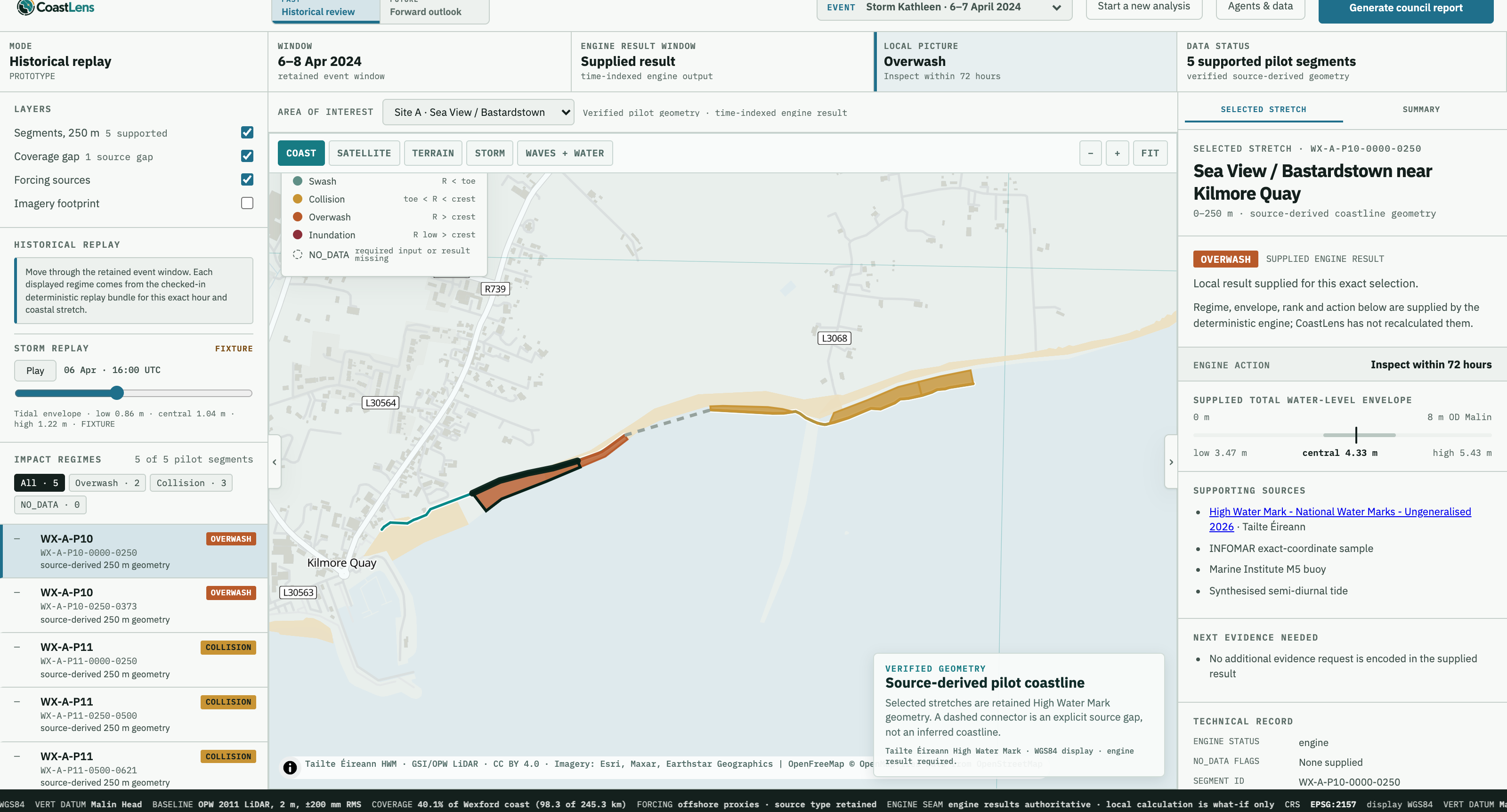
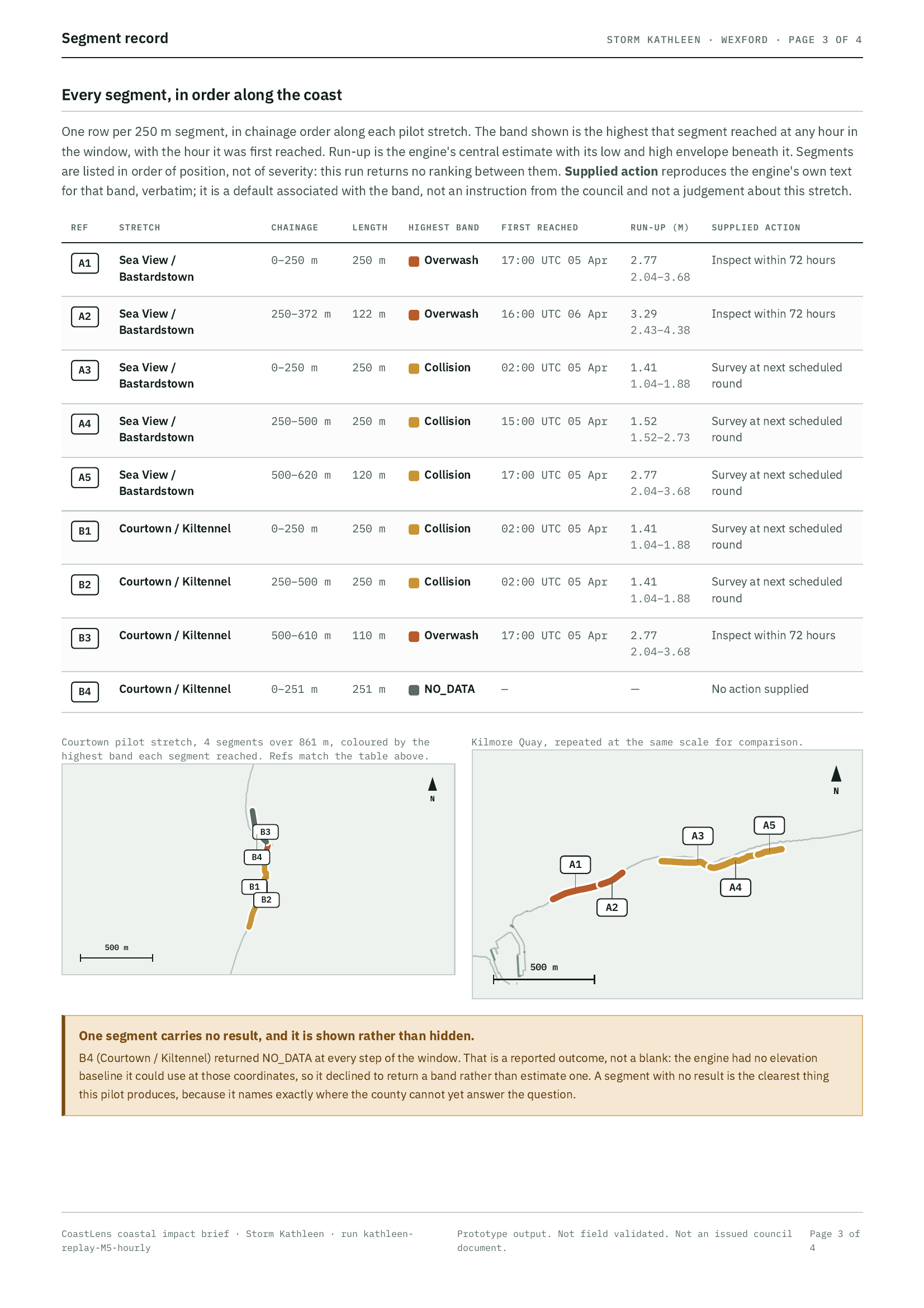
CoastLens GIS, Sea View near Kilmore Quay at 16:00 on 6 April 2024: two stretches of foreshore in Overwash orange, three in Collision amber, the selected stretch reading Inspect within 72 hours

Future planning · 01

A storm is coming.

Start a 24-hour local outlook the moment the forecast is issued
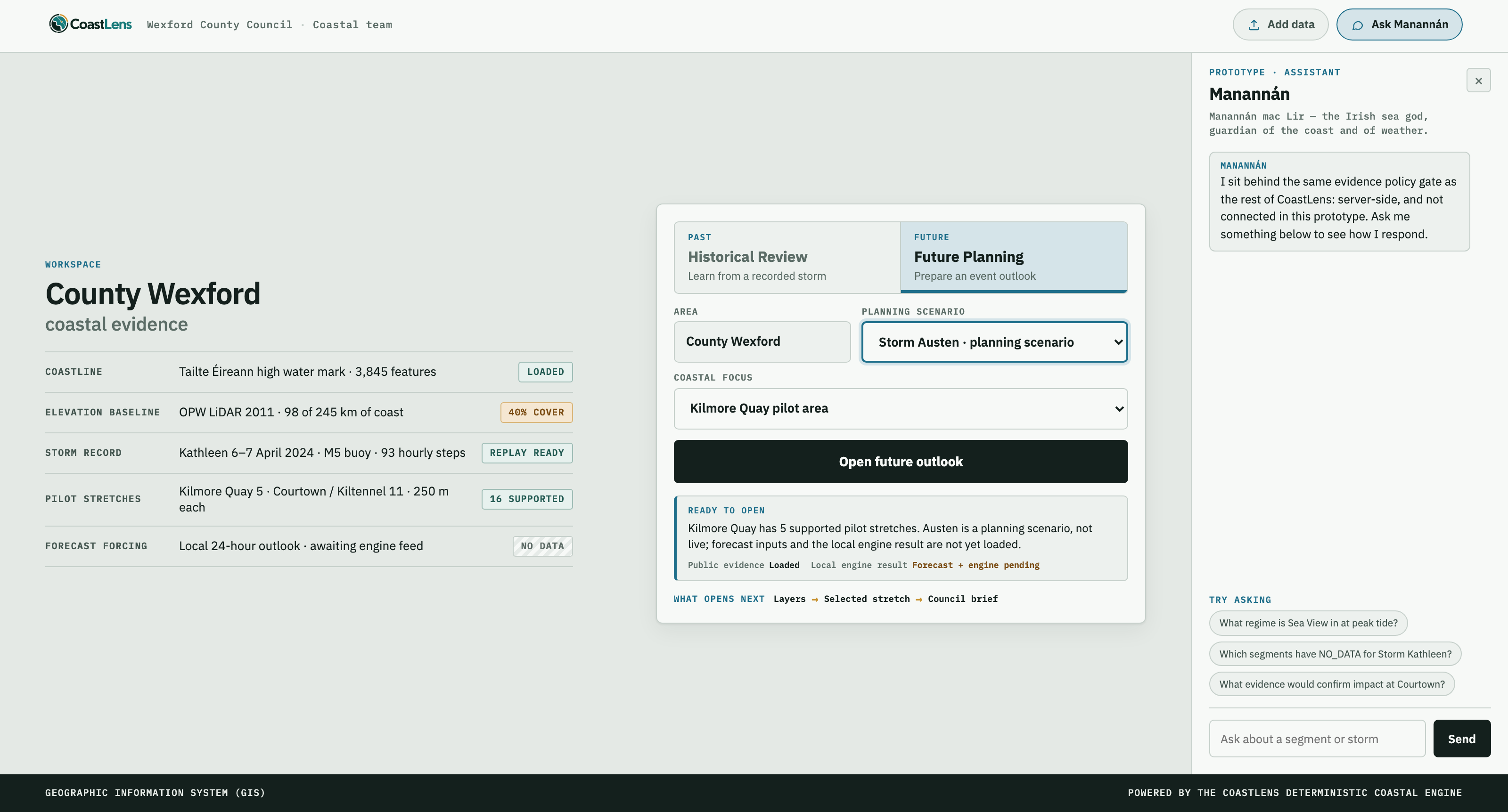
CoastLens workspace with Future Planning selected and the Storm Austen planning scenario chosen
→
Future planning.

Same engine, same evidence. Forecast forcing in place of the recorded storm.

Future planning · 02

Building continues

CoastLens GIS, County Wexford view with the What is being built layer on: 9,449 planning applications since 2021 drawn as dots coloured by decision, larger dots for schemes of two or more homes, many along the high water mark; legend labelled context, not a risk layer

The intelligence layer · agent runs, 11–12 September 2026

Agents feed the picture.

DiscoverParseCheckAssembleEngineApproved · John Robinson

    Supervised jobs a person starts and reviews, not a daemon. Every run keeps its source, licence and commit. A refusal on licence stays NO_DATA.

    The intelligence layer · the fleet

    Six agents. One loop.

    Each agent is a supervised job with one role. It prepares; the engine calculates; a named person approves. Runs shown are 11–12 September 2026.

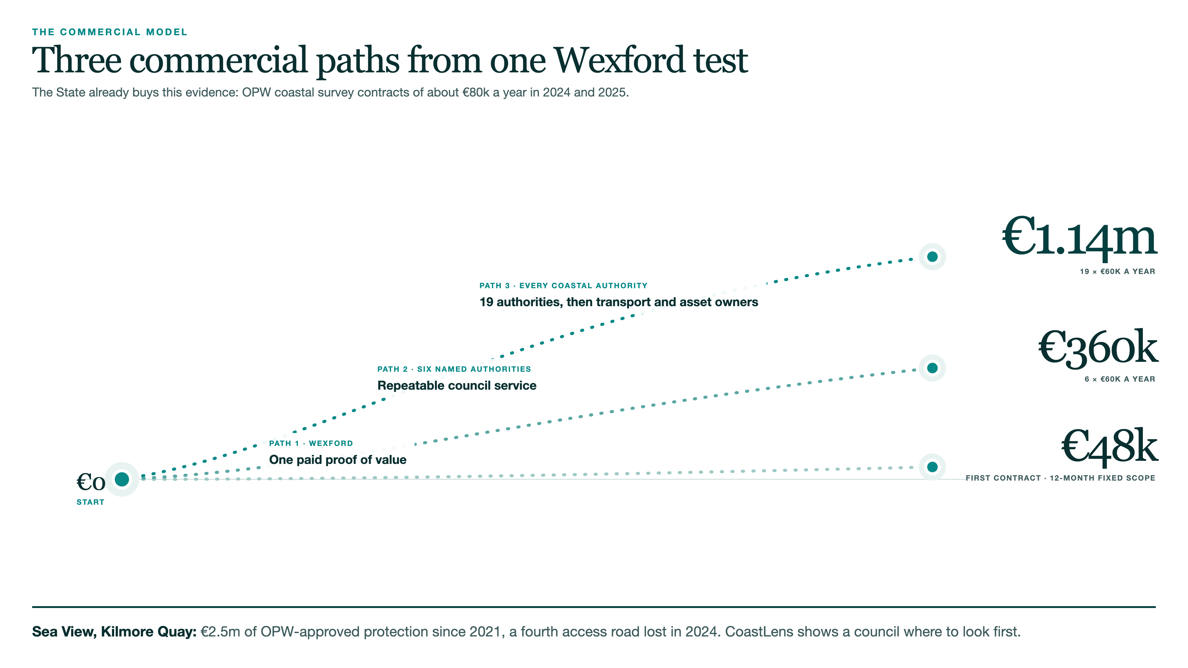
    Three dotted lines rising from a shared zero to €48k first contract, €360k a year for six named authorities, and €1.14m a year for all 19 coastal authorities; footer: Sea View, Kilmore Quay, €2.5m of OPW-approved coastal protection since 2021 and a fourth access road lost in April 2024. CoastLens does not stop erosion. It shows a council where to look first.

    The council output

    Downloadable reports

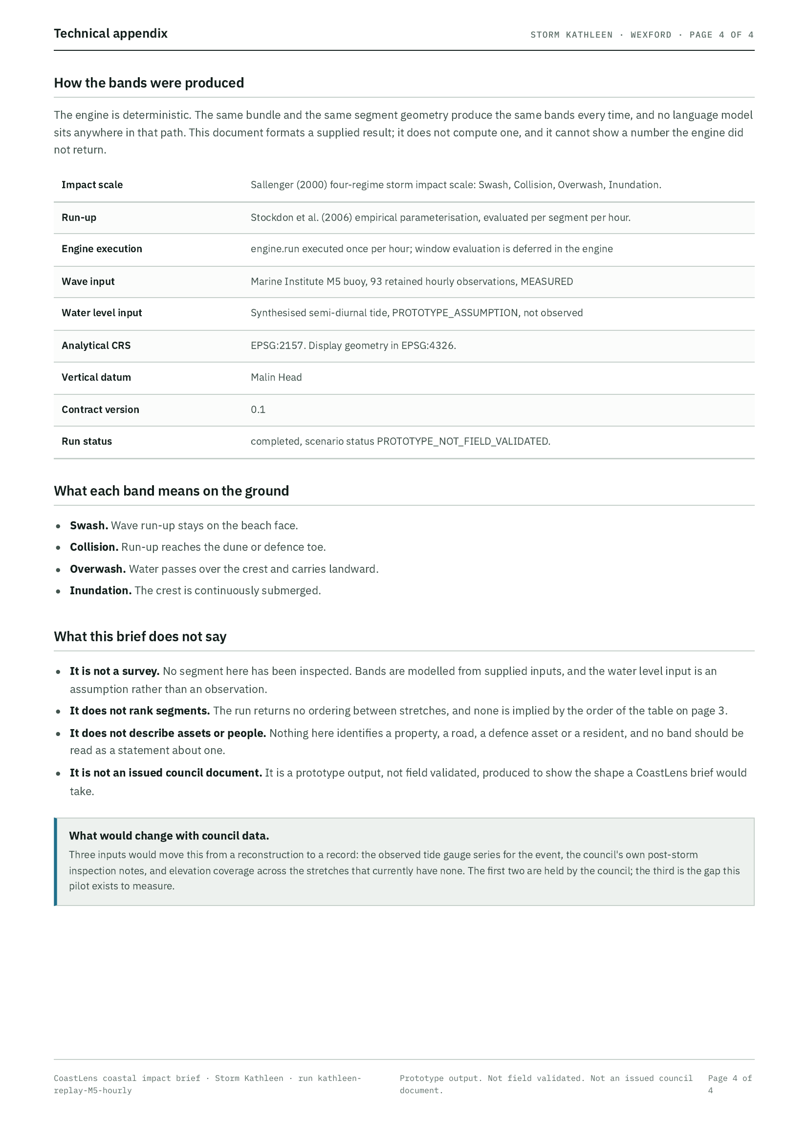
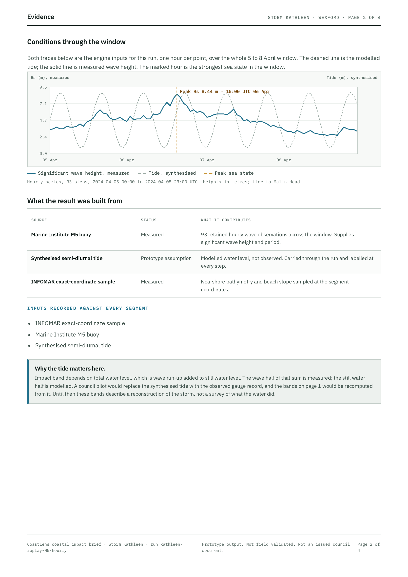
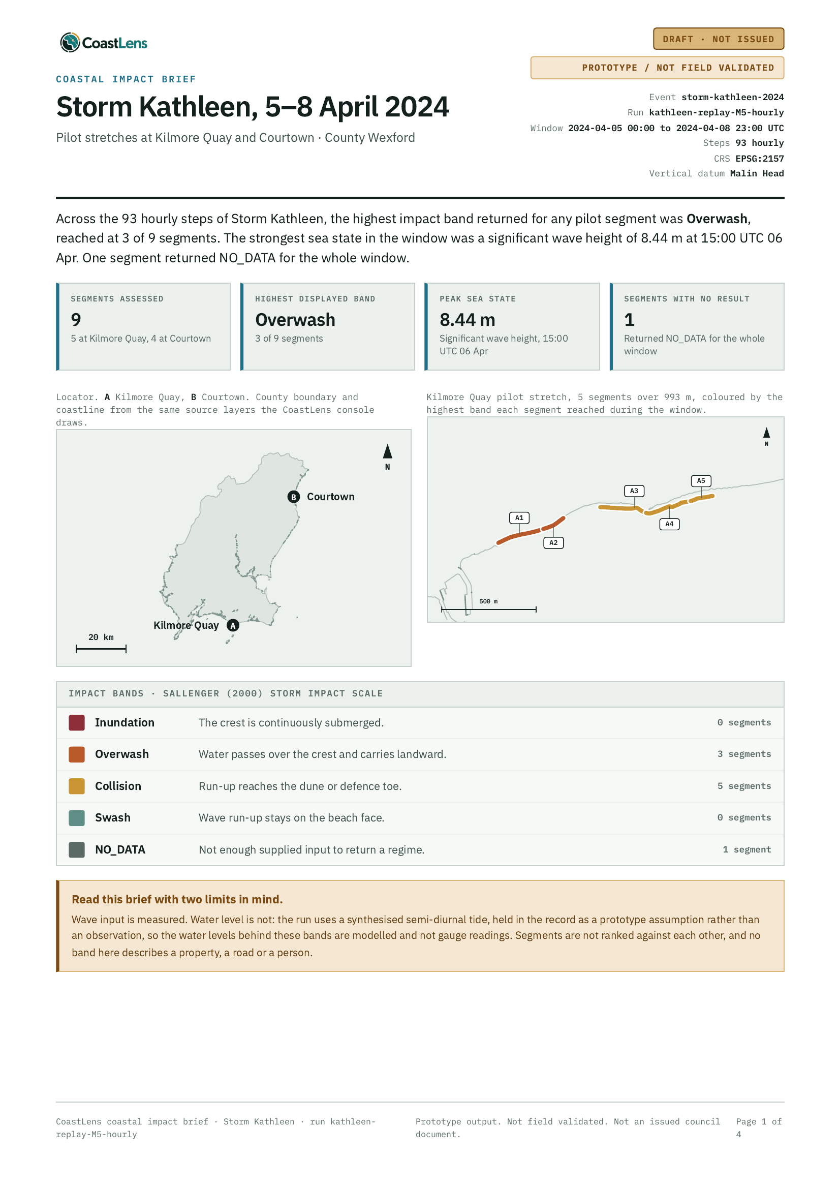
    Page 4, technical appendix: method, projection and provenance Page 3, segment record: every 250 m segment with its impact band Page 2, evidence: wave and tide traces through the storm window Page 1, decision brief: Storm Kathleen headline result and maps
    CoastLens

    Not optimised for mobile. This deck is built for a laptop screen.

    Turn your phone sideways to read it here, or open it on a laptop at coastlens.ie/presentation.

    Open the PDF instead →